

Ijraset Journal For Research in Applied Science and Engineering Technology
Aquifer Mapping for Ground Water Management
Authors: Dr. Bashir Ahmad Pandit
DOI Link: https://doi.org/10.22214/ijraset.2024.65831
Certificate: View Certificate
Abstract
Introduction
I. INTRODUCTION
To guarantee the efficient operation of an artificial recharge system, a comprehensive hydrogeological investigation must be conducted before to selecting the location and method of recharging. Since silting, chemical precipitation, and organic matter accumulation rapidly reduce infiltration capacity, artificial recharge structures must be regularly maintained. Making the injection or connection wells dual-purpose wells can lengthen the time between cleanings, but yearly de-silting is necessary for spreading structures other than subsurface dykes that are designed with an overflow or outlet. It is regrettable that regular maintenance is occasionally neglected until a drought occurs, at which point the structures need to be restored, because the buildings were constructed to mitigate drought. Many groups and individuals usually handle building maintenance. It is difficult to determine the amount of water that is present and usable in the strata that hold groundwater since they are concealed beneath the surface. Therefore, it is imperative to estimate the same using indirect ways, which often opens people's eyes and provides crucial information to decision-makers for groundwater management that is sustainable. The complexity of the processes controlling the occurrence and movement of water makes the problem of groundwater assessment somewhat difficult. This is mainly because determining the location of groundwater in space and time, as well as its quantity and quality, requires a multidisciplinary scientific approach in addition to the collection of vast amounts of data. Therefore, the development, planning, and management of water resources depend heavily on the estimation of groundwater supplies. The scientific process of aquifer mapping uses a combination of hydrologic, geological, geophysical, and chemical disciplines as well as laboratory investigations to evaluate the amount, quality, and sustainability of groundwater in aquifers. It is expected that systematic mapping will increase our understanding of aquifers' hydrologic composition, geology conceptual frameworks, water levels and temporal fluctuations, and the prevalence of natural and man-made pollutants that affect groundwater mobility.
II. AQUIFER MAPPING IS NEEDED
Numerous development initiatives over the years have negatively impacted the groundwater regime in various parts of the nation. For groundwater conservation under different hydrogeological conditions, scientific planning is necessary to develop effective management techniques with community involvement and enhance groundwater governance. Through scientific investigations, the Central Ground Water Board (CGWB) and other federal and state agencies have produced a substantial amount of hydrological and hydrogeological data; however, these primarily pertain to administrative units and have infrequently mentioned the issues facing the entire aquifer system. Given the nation's new challenges, a methodical approach to data collection, generation, compilation, analysis, and synthesis is needed to provide accurate and thorough information about the various factors of groundwater resources existing in various hydrogeological settings.
A. The Purpose of Acquiring Maps
The following are the aquifer mapping goals, as stated:
- Aquifer characterization and lateral and vertical placements are normally delineated on a 1:50,000 scale, with further information up to a 1:10,000 scale in areas identified as priority areas.
- Groundwater quality assessment and availability quantification are essential for creating aquifer management plans and facilitating the sustainable management of groundwater resources.
- On a scale of 1:50,000, it describes the geochemistry, hydraulic characteristics, groundwater regime behaviours, aquifer geometry, and aquifer type of multi-layered aquifers.
- It completes the methodology and approach that will be used to implement the national aquifer mapping program throughout the entire country. It employs innovative geophysical techniques and demonstrates their value, efficacy, and applicability in a variety of hydrogeological contexts.
- It employs new geophysical techniques and demonstrates their application, efficacy, and use in diverse hydrogeological settings.
- It completes the strategy and technique that will be applied throughout the country to carry out the national aquifer mapping program.
- To develop an information and management system for aquifers based on the aquifer maps that have been produced for sustainable management.
- The exercises to develop micro-level aquifer mapping can be scaled up by putting the lessons learnt into practice.
III. AQUIFER MAPPING AND GROUNDWATER STUDIES IN INDIA
When in-depth research on aquifers and groundwater resources began in the 1950s, groundwater was thought to be a source for improving surface water supplies and increasing India's capacity for irrigation. The Exploratory Tube Well Organization (ETO) was founded at the time to identify appropriate sites and drill tubes or bore-wells for development purposes, while the Geological Survey of India's Ground Water Wing carried out groundwater research throughout the country. These two organizations were merged into the CGWB in 1972 with the goal of "developing and disseminating technologies and monitoring and implementing national policies for the scientific and sustainable development and management of India's ground water resources, including their exploration, assessment, conservation, augmentation, protection from pollution, and distribution, based on principles of economic and ecological efficiency." In order to comprehend the extent, characteristics, yield potentials, and development opportunities of important hydrogeological units around the country, the CGWB has been carrying out hydrogeological research over time.
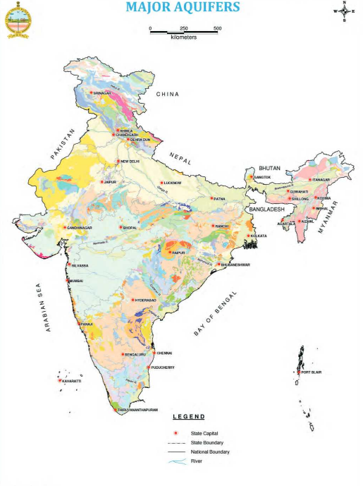
With a scale of 1:2 million, the Geological Survey of India published the first hydrogeology map of aquifers in 1969 under the title "Geohydrological Map of India." Based on this research, CGWB then published an updated "Hydrogeological Map of India" at a scale of 1:5 million. Based on surveys, exploration, and specialized research, the CGWB created its first edition of the hydrogeological map of India at 1:2 million scales in 1985 and its second version in 2001. Based on stratigraphy and the information available at the time, the map contained nine important aquifers (hydrogeological units).
Additionally, in order to evaluate the effectiveness of using different geophysical tools and to finish the protocol for using various geophysical methods to assist hydrogeological research in the nationwide aquifer mapping, the Board has started five pilot aquifer mapping projects in conjunction with the nationwide aquifer mapping in a variety of hydrogeological settings across the nation, including hard rock, coastal, basaltic, desert, and alluvial terrains.
At that time, the nation's growing reliance on groundwater as a source of fresh water and the mounting pressure on its available resources made it clear that aquifer units needed to be defined more broadly and strategies for their long-term development needed to be established. As a result, data from its own and many other organizations' scientific studies were added to the CGWB's database, enabling the Board to create the first aquifer map of the country at a scale of 1:125,000, featuring 14 major aquifer systems that were further subdivided into 42 main aquifers in the initial phase. However, in order to map these aquifer systems at a scale of 1:50,000, the current national aquifer mapping effort was started.
IV. GROUNDWATER CONSERVATION AND MANAGEMENT
Utilized to support and enhance these investigations. These efforts led to the identification and demarcation of a large number of hydrogeological units that could be created to supplement the surface water sources. Numerous projects were initiated in major Indian basins in collaboration with international organizations to carry out water balance evaluations on aquifer groundwater regimes and development prospects.
As groundwater resources were developed more extensively to meet growing demands and the resulting negative environmental effects, the CGWB's hydrological research began to shift its focus from development to management in the early 1990s. Consequently, the CGWB's scope of activity was expanded to include research on groundwater augmentation, regulation, and integrated water resources management through the cooperative use of surface and groundwater resources. Understanding the importance of stakeholder involvement in groundwater management led to an expansion of the Board's Information, Education, and Communication (IEC) operations. Over the last ten or so years, the CGWB has directed several of its activities on "sustainable ground water resource management."
With a scale of 1:2 million, the Geological Survey of India published the first hydrogeology map of aquifers in 1969 under the title "Geohydrological Map of India." Based on this research, CGWB then published an updated "Hydrogeological Map of India" at a scale of 1:5 million. Based on surveys, exploration, and specialized research, the CGWB created its first edition of the hydrogeological map of India at 1:2 million scales in 1985 and its second version in 2001. Based on stratigraphy and the information available at the time, the map contained nine important aquifers (hydrogeological units).At that time, the nation's growing reliance on groundwater as a source of fresh water and the mounting pressure on its available resources made it clearer than ever that aquifer units needed to be defined more broadly and strategies for their long-term development needed to be established. As a result, data from its own and many other organizations' scientific studies was added to the CGWB's database, enabling the Board to create the first aquifer map of the country at a scale of 1:125,000, featuring 14 major aquifer systems that were further subdivided into 42 main aquifers in the first phase. However, in order to plan their sustainable development with stakeholder participation, the present national aquifer mapping initiative was started with the goal of mapping these aquifer systems at a scale of 1:50,000 or larger. Additionally, in order to evaluate the effectiveness of using different geophysical tools and to finish the protocol for using various geophysical methods to assist hydrogeological research in the nationwide aquifer mapping, the Board has started five pilot aquifer mapping projects in conjunction with the nationwide aquifer mapping in a variety of hydrogeological settings across the nation, including hard rock, coastal, basaltic, desert, and alluvial terrains.
V. MANAGEMENT OF AQUIFERS
Based on the results of aquifer mapping and modeling, the CGWB conducts an aquifer management follow-up program with an emphasis on participatory groundwater management plans. The development of management plans involves stakeholders and takes into consideration local water concerns as well as socioeconomic considerations. A excellent answer is found at the watershed or village level. A comprehensive picture of each location's aquifers is provided to the stakeholders, together with information on water availability, budgeting, and quality before and after the monsoon season. For example, aquifer management plans specify areas for artificial recharge, allow groundwater abstraction to enhance the watershed's water balance, and pinpoint alternative water sources, especially in geologically contaminated areas where aquifers that are uncontaminated by aquifer mapping could be tapped.
VI. USING GIS FOR GROUNDWATER MANAGEMENT
Numerous approaches are used to provide information on the characteristics and potential locations of groundwater resources. Remote sensing (RS) data, such as satellite photography, can be processed with advanced software to reveal groundwater conditions and their occurrences (Abdelkareem and El-Baz, 2015). As a result, groundwater mapping and exploration employing geographic information system (GIS) and satellite remote sensing techniques are successful, particularly in dry regions (Abdalla, 2012; Moubark and Abdelkareem, 2018). Advances in image processing techniques can help us better understand the spatial distribution of groundwater (Abdelkareem et al., 2012; Lentswe and Molwalefhe, 2020; Saraf and Choudhary, 1998; Yeh et al., 2016). Because GIS enables the study and integration of a large variety of spatially distributed data under several logical conditions, it is beneficial for delineating possible groundwater areas. Several studies have successfully mapped the groundwater availability zone using GIS techniques. Ground surveys employing geophysical, geological, and hydrogeological methods are the cornerstone of traditional methods used to locate, characterize, and chart the groundwater potential zones. Generally speaking, these surveys are costly and time-consuming (Israil et al., 2006). However, geospatial technologies can generate and model valuable data in a number of geoscience disciplines in a timely and cost-effective manner (Moghaddam et al., 2015; Russo et al., 2015). Researchers have used a range of methods to identify and map groundwater potential regions, such as logistic regression (Pourtaghi and Pourghasemi, 2014), weights of evidence (Lee et al., 2012; Pourghasemi and Beheshtirad, 2015), evidential-belief function (Mogaji), multicriteria decision analysis (Mukherjee et al., 2013; Rahmati et al., 2015), and probabilistic models like frequency ratio (Ozdemir, 2011; Razandi et al., 2015).
Several factors influence the production of maps that depict groundwater resources. These include stream networks, lithology, topography, lineaments, and climate-related thematic layers (Ganapuram et al., 2009; Srivastava et al., 2012). They are developed using GIS tools. Such technologies can be employed in a number of environments, including arid regions. The GIS's spatial analyst tool merges the thematic layers using a weighted overlay technique (Sikdar et al., 2004).
Conclusion
Globally, groundwater resources are severely stressed as a result of overuse and substantial climatic change throughout time. As the world\'s need for drinkable water for industrial, agricultural, and human use grows, so does the need to evaluate groundwater potential and aquifer productivity. The goal of systematic aquifer mapping is to increase our understanding of the hydrologic composition of aquifers, their geologic foundations, their water levels and temporal fluctuations, and the prevalence of natural and man-made pollutants that are influencing the potability of groundwater. To manage the groundwater resource through aquifer-based management against rising demand, it is necessary to identify and map the aquifers at the micro scale, measure the groundwater resource precisely at the aquifer level, assess the water quality of the aquifer, characterize the yield and storage capabilities of the aquifer, identify the recharge and discharge zones of the aquifer, and establish institutional arrangements.
References
[1] Abdalla, F. 2012. Mapping of groundwater prospective zones using remote sensing and GIS techniques: A case study from the Central Eastern desert, Egypt. J Afr Earth Sci. 70:8–17. [2] Abdelkareem, M., El-Baz, F. and Askalany, M. 2012. Groundwater prospect map of Egypt’s Qena Valley using data fusion. Int J Image Data Fus. 3(2):169–189. DOI:10.1080/ 19479832.2011.569510 [3] Abdelkareem, M. and El-Baz, F. 2015. Analyses of optical images and radar data reveal structural features and predict groundwater accumulations in the central Eastern Desert of Egypt. Arab J Geosci. 8:2653–2666. [4] Alston, P.H. and Watkins, R. 1973. Apple breeding at East Malling. Proc Eucarpiafruit Breed Symp. 14–29. Central Ground Water Board (CGWB). 1994. Manual on Artificial Recharge of Ground Water. Technical Series M, No. 3, Central Ground Water Board, Faridabad, March 1994, 215 p. [5] Chenini, I. and Mammou, A.B. 2010. Groundwater recharge study in arid region: An approach using GIS techniques and numerical modeling. Comput Geosci. 36:801–817. [6] Dar, I.A., Sankar, K. and Dar, M.A. 2010. Remote sensing technology and geographic information system modeling: An integrated approach towards the mapping of groundwater potential zones in Hardrock terrain, Mamundiyar basin. J Hydrol. 394:285–295. [7] Faust, N.L., Anderson, W.H. and Star, J.L. 1991. Geographic information systems and remote sensing future computing environment. Photogramm Eng Remote Sens; (United States). 57. [8] BK-TandF-KUMAR_9781032398518-230495-Chp18.indd 337 28/08/23 1:53 PM 338 Advances in Water Management Under Climate Change Ganapuram, [9] S., Kumar, G., Krishna, V.I.V., Kumar, M., Kahya, E.M. and Demirel, C. 2009. Mapping of groundwater potential zones in the Musi basin using remote sensing data and GIS. Adv Eng Softw. 40(7):506–518. [10] Heviánková, S., Marschalko, M., Chromíková, J., Kyncl, M. and Korabík, M. 2016. Artificial ground water recharge with surface water. IOP Conf Ser: Earth Environ Sci. 44:022036. http://iopscience.iop.org/1755-1315/44/2/022036. [11] Hinton, J.C. 1996. GIS and remote sensing integration for environmental applications. Int J Geogr Inf Syst. 10:877–890. India: India’s Water Economy, Bracing for a Turbulent Future – 2006; Report No. 34750-IN, Agriculture and Rural Development Unit South Asia Region, Document of the World Bank. [12] Israil, M., Al-Hadithi, M. and Singhal, D.C. 2006. Application of a resistivity survey and geographical information system (GIS) analysis for hydrogeological zoning of a piedmont area, Himalayan foothill region, India. Hydrogeol J. 14:753–759. [13] Kannan, S. and Mathew, 2008. GIS and remote sensing for artificial recharge study in a degraded Western Ghat terrain. J Centre Stud Res Eng. 1–15. [14] Lee, S., Kim, Y.S. and Oh, H.J. 2012. Application of a weights-of-evidence method and GIS to regional groundwater productivity potential mapping. J Environ Manage. 96:91–105. [15] Lentswe, G.B. and Molwalefhe, L. 2020. Delineation of potential groundwater recharge zones using analytic hierarchy process-guided GIS in the semi-arid Motloutse watershed, eastern Botswana. J Hydrol Reg Stud. 28:100674. [16] Mogaji, K.A., Lim, H.S. and Abdullah, K. 2015. Regional prediction of groundwater potential mapping in a multifaceted geology terrain using GIS-based Dempster–Shafer model. Arab J Geosci. 8:3235–3258. [17] Moghaddam, D.D., Rezaei, M., Pourghasemi, H.R., Pourtaghie, Z.S. and Pradhan, B. 2015. Groundwater spring potential mapping using bivariate statistical model and GIS in the Taleghan watershed, Iran. Arab J Geosci. 8:913–929. [18] Moubark, K. and Abdelkareem, M. 2018. Characterization and assessment of groundwater resources using hydrogeochemical analysis, GIS and field data. Arab J Geosci. 11:598. [19] Mukherjee, S., Mukherjee, S., Garg, R.D., Bhardwaj, A. and Raju, P.L. N. 2013. Evaluation of topographic index in relation to terrain roughness and DEM grid spacing. J Earth Syst Sci. 122:869–886. [20] Naghibi, S.A., Pourghasemi, H.R., Pourtaghi, Z.S. and Rezaei, A. 2015. Groundwater qanat potential mapping using frequency ratio and Shannon’s entropy models in the Moghan watershed, Iran. Earth Sci Inf. 8:171–186.
Copyright
Copyright © 2024 Dr. Bashir Ahmad Pandit. This is an open access article distributed under the Creative Commons Attribution License, which permits unrestricted use, distribution, and reproduction in any medium, provided the original work is properly cited.

Download Paper
Paper Id : IJRASET65831
Publish Date : 2024-12-09
ISSN : 2321-9653
Publisher Name : IJRASET
DOI Link : Click Here
 Submit Paper Online